
In Earth’s driest desert, humans build monuments: shrines to dead travelers on a dangerous highway and tremendous geoglyphs. Why here?

Public Domain Image via Pixabay
I love the desert. The colors, the ability to see for long stretches, the isolation and the resilience of life there. I am also completely aware of its power. There is mystery there that could kill me. The deserts I am acquainted with are those of the North American West, especially those in the four corners region where Utah, Arizona, New Mexico and Colorado meet. Today I am looking at another from the safety of my living room (a much less expensive journey): the Atacama of northern Chile.
The Atacama is the driest desert on the planet, nestled up against the foothills of the Andes. The interior of the desert contains miles and miles where there is nothing but dust, dirt, gravel, and sand. Great swaths of the Atacama don’t support plant life… even bacteria, insects and fungi have a difficult time here. At least there are no mosquitos.
The most surprising thing about the Atacama for me is that there are signs of human beings. The Pan-American highway runs through the desert, a monotonous and bleak section of two-lane highway that carries heavy truck, bus and car traffic. It’s called the Ruta 5 and it is horribly dangerous. The road is littered with shrines to dead travelers. People come out here to maintain these shrines, which is dangerous in itself, replacing flowers and adding items. Please take a look at this wonderful blogpost from notesatcamelidcountry to see some of these testaments to those who have passed on. You can also find more about the Atacama on that spectacular website.
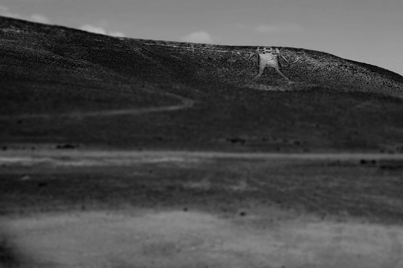
Image © Christian Barahona Miranda with CCLicense
Not far from here there are large geoglyphs made from rocks laid in patterns on the sand. They aren’t as famous as those on the Nazca Plains in Peru, but that is likely because of their extreme remoteness. The most famous of these is the Atacama Giant, pictured here. Why arrange a bunch of rocks in the desert to make art that is best viewed from the sky?
Travelers bringing goods from other parts of the continent have trekked through the Atacama for centuries and found the desert even more threatening than our modern day truckers. They had no shelter and their road was much more difficult to find. Perhaps these images were a form of navigation. Moving from image to image broke up the desert and helped judge time and distance as well as keeping one on the right path. Perhaps they had a spiritual or prayerful element?
These geoglyphs mark time and space and help humankind remember the past. Is this so different than the shrines by the side of the road? Is it any different than images we make in our own communities?